Murchison to Maruia Springs #
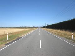
Ten or fifteen kilometres past Murchison heading south on HW6 you will come to the turn off to Springs Junction along HW65. A nice alternative is to follow the Matakitaki Valley Rd out of Murchison, rejoining HW65 after 43 km, roughly 17 km shy of Maruia. This mostly gravel back road adds about 3 km distance plus at least 100m of climbing, but it is pleasantly quiet and blissfully free of traffic.
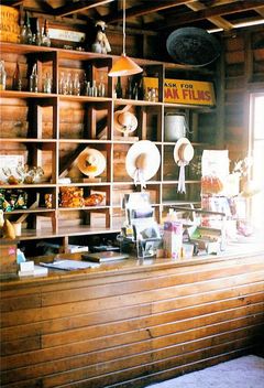
There are no stores on either route, although there is a good café at Maruia (not to be confused with Maruia Springs). Some years ago this used to be a store run by a German couple and their small children. They were an exceptionally friendly family and I was grateful for a cold draught of homebrew they shared with me. I camped under the tree close to the store that evening and was allowed access to a small kitchen and shower in their backpackers. They clearly loved the place but were later deported for an old drugs offence they had failed to disclose when they entered the country from Germany. A sad end to a couple who were devoted to a place they had discovered far from home and who clearly wished to put the past behind them.
Take plenty of water with you. On a hot day you can be using a litre of water every ten kilometres on the steep bits. There are streams if you have a filter and the odd farmhouse which will likely allow you to fill your water bottles, so no real problems providing you are prepared.
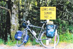
Once you reach Springs Junction (garage and store/tearooms), take a left hand turn and head along SH7. Fifteen or so kilometres past Springs Junction you will come to Maruia Springs. Maruia Springs has a pub but, more importantly, it has hot pools. This is a marvellous place to forego the camp stove for a night and shout yourself a meal. Camping is available on site, but limited to camper vans. The price of a room is a bit steep, but this is a wonderful way to soak off the weary kilometres, and the Japanese style bath house is spacious and relaxing with large windows that look out over the bushy neighbouring hillsides.
If you prefer a cheaper option, there are DOC camps at Marble Hill, 6.5 km east of Springs Junction, Deer Valley, 20 km east of Springs Junction, and Boyle Village over the pass.
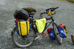
If you are lucky, at this point you will start to come across Keas, very common in this area. Keas are colourful, native parrots and have a friendly and mischievous nature. Stories about their unclipping wing mirrors and taking apart tents are mostly exaggerated, but don't underestimate those sharp claws and tough little beaks... This picture shows a couple of Keas taking apart a friend's bike. The German cyclist in question wandered off to take photos and, looking back, wondered why a group of other tourists had gathered around her bike. She soon found out why!