Tākaka to Anatori #
From Tākaka to Collingwood is around 25 km. This is a pleasant undulating road made interesting by the midway presence of a remote folksy coffee bar/tavern that is the haunt of many local musicians in the evenings. Directly opposite is the Shambhala hostel (takes tents), probably one of the most romantic hostels in New Zealand. The hostel looks out on panoramic views of Golden Bay and is notable as an eco-retreat with a wide range of activities. There is no store close by however and the driveway down to the hostel is a long one and a bit of a climb back.
Collingwood is a further 14 km on and the last substantial township at the top western point of the South Island. It sports a store, a pub, a motor camp, tea rooms and a tourist office. There is a good hostel here that provides free fresh bread for breakfast and also has spaces for tents. Few cyclists pedal beyond this point because there is no through road and you have to come back the same way. Sadly, cyclists often miss some real scenic gems because of this.

The top of the South Island beyond Collingwood is a lovely, generally flat coast road (22 km) to Puponga where there is a café and tourist center. Beyond this point is Farewell Spit (guided tours only) a vast, broad sandy point curling out into the Tasman Sea.
In between Collingwood and Puponga are three great motor camps with tent sites close to the beachfront of Golden Bay. There is something magical about camping on the edge of a huge bay with the curving arm of Farewell Spit to your left and the Abel Tasman National Park in the blue distance to your right. At night the stars are sharper and brighter away from the city and the sea laps gently along the sandy foreshore. Take a walk before retiring to your sleeping bag and listen to the waves. This is a rare experience.

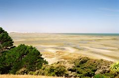
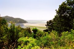
If you want to explore a fairly remote part of New Zealand few tourists go to, then stock up with supplies at Collingwood and take the inland road left at Seaford (15 km approx from Collingwood). This is the sole, gravel road that leads over to the West Coast and the Whanganui Inlet (10 km approx). Once you reach the inlet, the road splits left and right at a T-junction. The right leads up to the Kaihoko Lakes (10 km approx); the second, longer route, heads left and around the inlet toward the lonely hamlet of Mangarākau to the south (25 km). This is an isolated winding gravel road that crosses several estuaries and touches on New Zealand's early native timber logging days. The frequent stumps of old jetties and the still visible remains of wharf piles in the bays indicate that at one time a good deal of industry occurred here.
But today, the road is mostly fringed with bush and, except for a few hardy homesteads, is largely empty. Surprisingly, Mangarākau, although it has no store, has a very good coffee bar that also offers breakfast and lunch. And better still, just opposite is a fine hostel (takes tents) converted from what was once the local school. These are great finds in an otherwise isolated place.

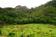
Around Mangarākau and the area generally, the landscape is heavy bush with large stands of red rata bordering steep limestone cliffs. To the left of the road is a great swamp and the atmosphere in the district is one of primeval forests. To walk in the evening here is to experience a slumbering landscape of enormous age and silence that is both majestic and, at times, a little eerie.
Beyond Mangarākau, the road continues ruggedly onward for another 20 or so kilometres along the coast and bordering farmland until it peters out at Anatori. You may wish to cycle further and visit the lighthouse at Kahurangi Point. If you do, there is yet another hostel out here. It has basic facilities and no store of course, but this is a 'Walden', a place for those seeking solitude and reflection. A wild and windswept west coast foreshore is close by and there are stretches of empty beach for miles in both directions. Write your novel, your poetry or just relax here, but bring supplies!